Be'er Sheva
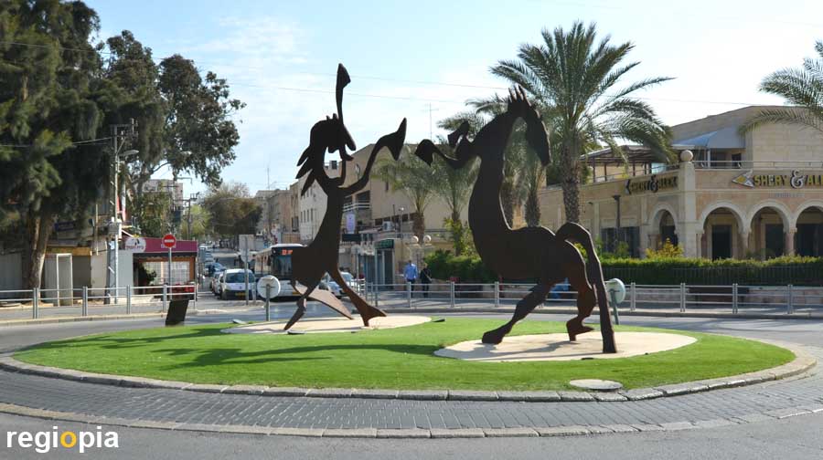
The city of Be'er Sheva is the gateway to the Negev. Be'er Sheva has around 220,000 inhabitants and is located on the border between the fertile part of Israel and the desert. The city is around 90 kilometers south of Tel Aviv. You should plan around 1.5 hours for the journey via the Highway 6 and the road 40. It is around 220 kilometers to Eilat. Be'er Sheva has a small center with low buildings. The center is around the French Commando Circle with two metal horses. Be'er Sheva is growing rapidly, there are many residential towers in the whole city, but it is not an interesting city. Attractions of Be'er Sheva include the Negev Art Museum, the Turkish Train Station and the Abraham Fountain.
This Negev travel guide shows the places of interest along the roads 40 and 90 to Eilat and on the way back along road 90 towards the Dead Sea and on road 25 back to Be'er Sheva.
Sde Boker
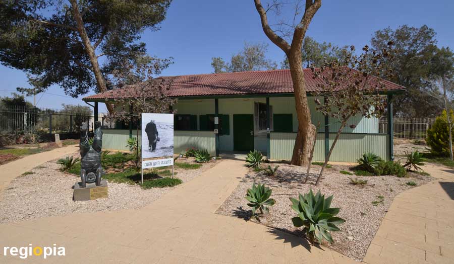
Sde Boker is a kibbutz in the Negev, where Ben Gurion lived between 1953-1955. After retiring in 1963, he moved back in and lived in this house until 1973. His house has been preserved and is located in a museum park. The Ben Gurion house in Sde Boker is a modest wooden house with study, kitchen and living room. Ben Gurion moved to the Negev because he saw the future of his country in the desert. "Make the desert bloom" is the solution for Israel. This goal is clearly illustrated in the Ben Gurion Desert Home.
Ben Gurion's tomb is also in Sde Boker, but on the southern outskirts on a hill from which you can see far into the desert.
Wadi Hawarim
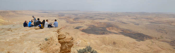
About 2 kilometers behind Sde Boker there is a viewpoint from which you can see the desert for the first time. The Wadi Hawarim sign leads to a dusty parking lot from which you can see the valley below. If you follow the dry river bed down, you will come back to Sde Bocker.
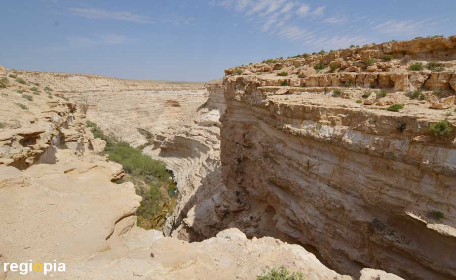
En Awdat National Park
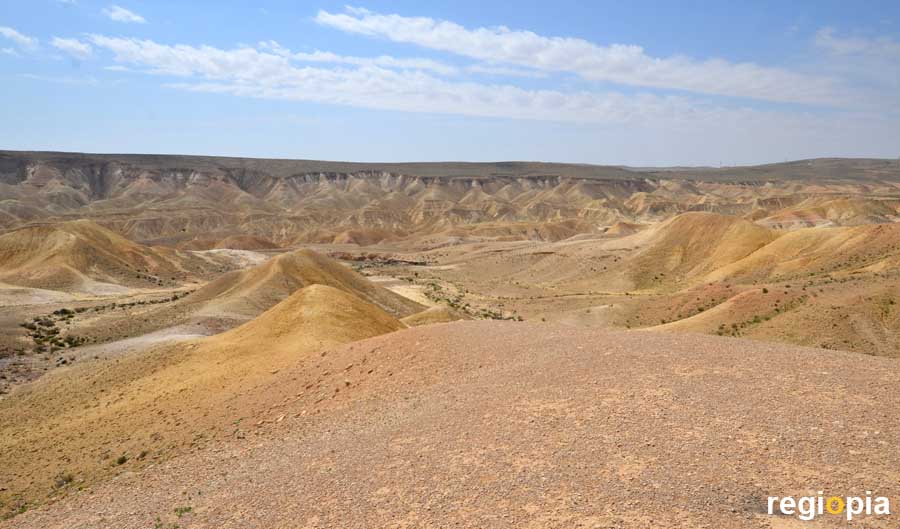
The En Awdat National Park offers an impressive gorge, with steep cliffs. The valley was created by the Wadi Zin, which cut its way through the Avdat Plateau. En Awdat National Park has two entrances, the lower one is in the valley the access is via a road from Sde Boker. From here you can hike into the canyon. The other entrance is at Highway 40. But from here you cannot descend into the Canyon. There is a viewing platform from which you can look into the valley (photo).
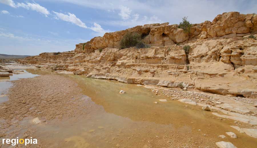
Nahal Zin
The Nahal Zin or Wadi Tsin is the river that created the canyon of the En Awdat National Park. If you walk to the viewpoint at the upper parking lot, you can see the river bed of the Nahal Zin. When you come in spring you can see water. The wadis can become very dangerous if they carry water. The flash flood usually comes very suddenly when it rained in the mountains the day before. At the entrance you should inquire whether you can hike in the riverbed. You should not drink the water and take enough drinking water with you instead.
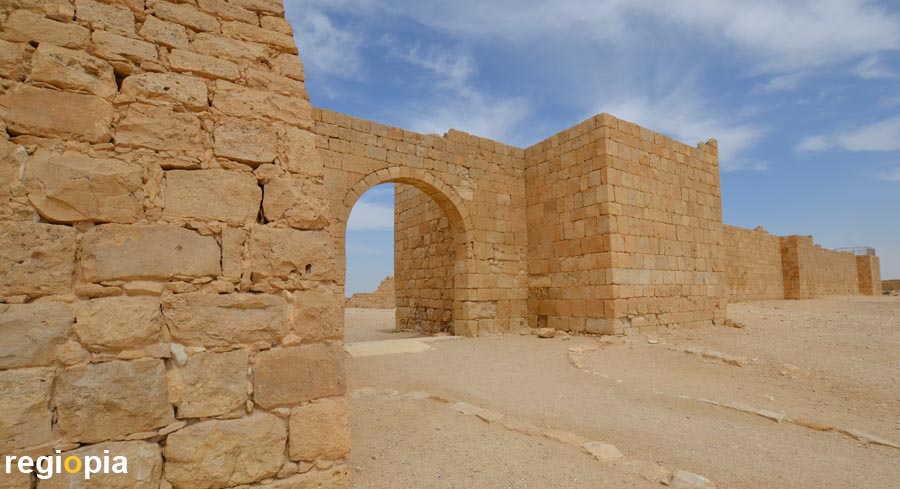
Avdat
The ruined city of Avdat is in the middle of the Negev. It was a station on the Nabataean Incense Route, which controlled their empire from Petra. The Incense Route led from Saba in what is now Yemen, across the Arabian Peninsula to the port of Gaza. From here the precious goods were shipped to Europe. There were many supply posts along the caravan route. Avdat is situated on a hill top above the road and has controlled this section since around 400 BC. The city prospered until the Byzantine period. When it was conquered by the Arabs in 636 the city declined. From 1870 the ruins were archaeologically examined. In 2005 Avdat was declared a UNESCO World Heritage Site along with other stations on the Incense Route.
There are many well-preserved buildings in Avdat. The city wall underscores the fortitude of the settlement, which had an additional military camp nearby built by the Romans. Inside the city wall you will see a palace, temples and churches. The remains of a wine press, a Roman watchtower and the foundations of the settlement can be seen outside the wall.
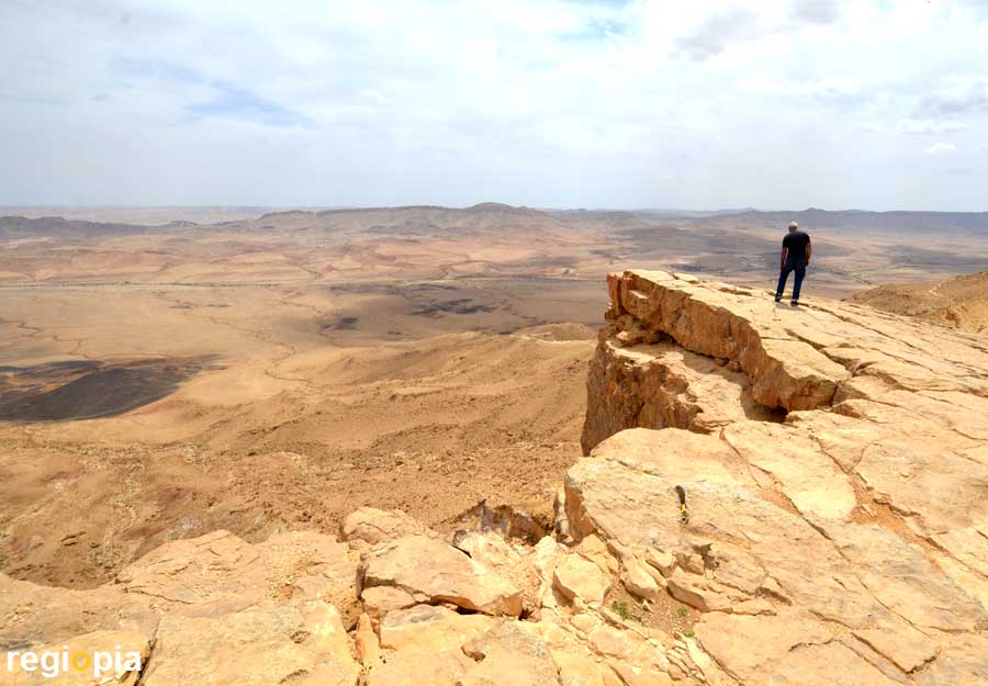
Mitzpe Ramon
The 5,000 soul village of Mitzpe Ramon is located directly on the crater rim of Machtesh Ramon. The erosion crater is around 40 kilometers long and between 2-10 km wide. Makhtesh Ramon crater was created by washing out sand in connection with a geological lifting of the area. This created a spectacular giant crater, on the edge of which sits Mitzpe Ramon. The Mitzpe Ramon Visitor Center with museum and restaurants is right on the edge. The round structure looks like a James Bond villain headquarters from the 1970s.
You can walk along the edge of the slope, there are several viewpoints. If you have a little more time, you can cross the crater on the Israel National Trail.
HaMinsara / Carpentry
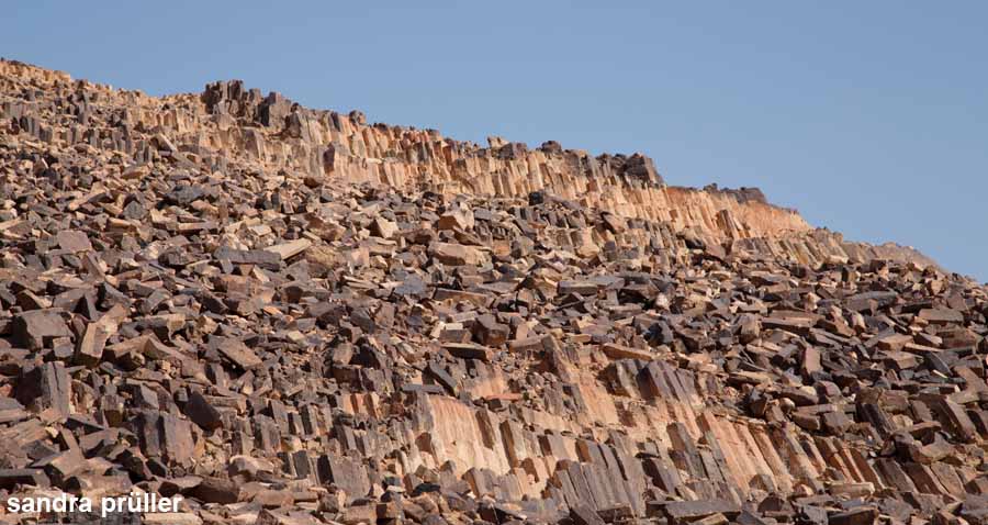
If you follow the road 40 from Mitzpe Ramon in the direction of Eilat, you will reach the rock formation HaMinsara / Carpentry after just a few kilometers. From the parking lot you can see a black pile of stones and a wooden walkway that leads to the hill top. The special thing about HaMinsara (carpentry) are the hexagonal stones that lie around the hill in thousands. The stones look like basalt stones in Northern Ireland at the Giant's Causeway. Basalt is formed at over 900 ° C when the volcanic rocks slowly cool down. The stones from The Carpentry look like sandstone, so it is believed that they could also have been created by the heat of the Negev.
Holot Tsivoniyim / Colored Sand Park
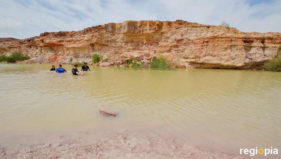
The next attraction awaits visitors less than 1 kilometer behind The Carpentry. In the Colored Sand Park you can see many different shades of sand that came to the surface due to the erosion of the Machtesh Ramon crater. After the rain, small ponds form in the pits, which some visitors use for swimming.
If you drive up the crater rim on the 40 to the south, you can visit the Ammonites Wall on the Israel National Trail. You have to walk about one kilometer from the road ito the desert, it goes slightly uphill. The signage and the parking facilities are poor. The ammonites are located on the right side of the trail. A small sign points to the wall. The ammonites are about 25 cm diameter stone rings. Don't forget water.
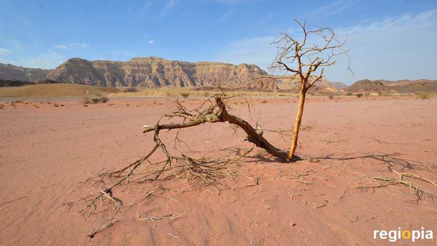
Timna Park
About 25 kilometers north of Eilat is the Timna National Park. Here you can drive on asphalted roads through the desert landscape of the Negev. In Timna Park you can spend a whole day and even spend the night. There are numerous rocks and landscapes worth seeing. The park costs admission, but it's worth it. Fantastic landscapes and great photo opportunities make Timna Park one of the most beautiful places in Israel.
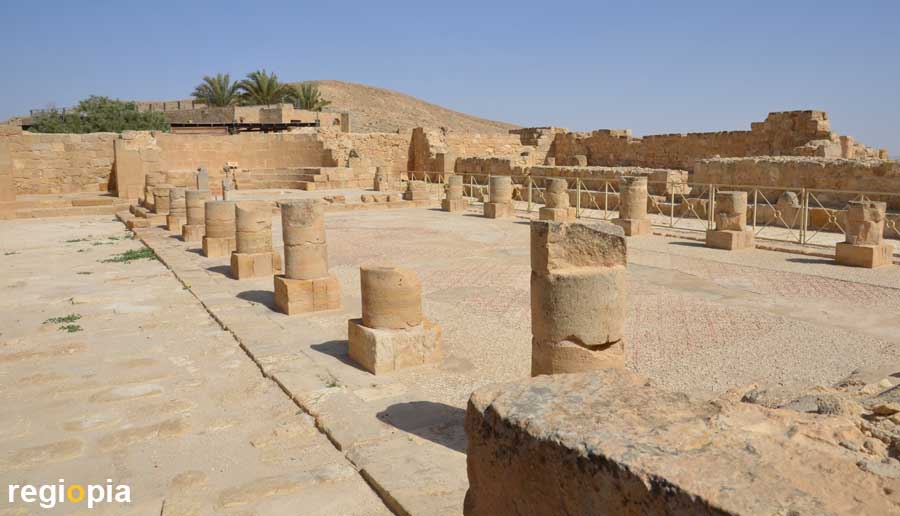
Mamshit
Mamshit is located between the Dead Sea and Be'er Sheva on Highway 25, about 5 kilometers east of Dimona. Like Avdat, Mamshit was a city of the Nabataeans on the Incense Route. Mamshit was built around 70 AD and lies above the Nahil Mamshit stream, which supplied the town with water. The Nabataeans were excellent water experts who collected the rainwater in large, covered water basins and cultivated land in the desert.
Mamshit was enclosed by a city wall, which at that time had around 1,000 residents. In 106 the Nabataeans were conquered by the Romans. Mamshit later belonged to the Byzantine Empire. The churches, the remains of which can still be seen today, were built at this time. The photo shows the Eastern Church. After the Islamic conquest in 636, the city was abandoned.
Many structures are relatively well preserved. The walls were partially rebuilt and new supports were added, giving the impression of walking through a city again.
Negev Tourist Map
ads
Travel Guide Negev
ads
ads