Plan de Corones
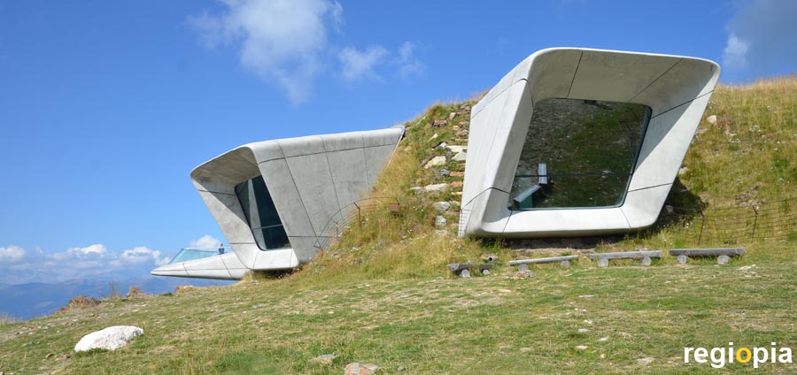
The Plan de Corones (german: Kronplatz) is a 2,275 m high mountain south of Bruneck. Cable cars and ski lifts meet on the summit from several directions. In summer the plateau is a large meadow with a some attractions. Plan de Corones is a popular starting point for paragliders. The main attraction is the Messner Mountain Museum MMM (photo) designed by the British architect Zaha Hadid, who also designed the ski jump in Innsbruck. Another museum on the Plan de Corones is the LUMEN Museum of Mountain Photography with a panoramic restaurant. There are also mountain huts with other restaurants on the summit. The magnificent view of the mountain scenery of the South Tyrolean Alps is great.
www.messner-mountain-museum.it
Lago di Carezza
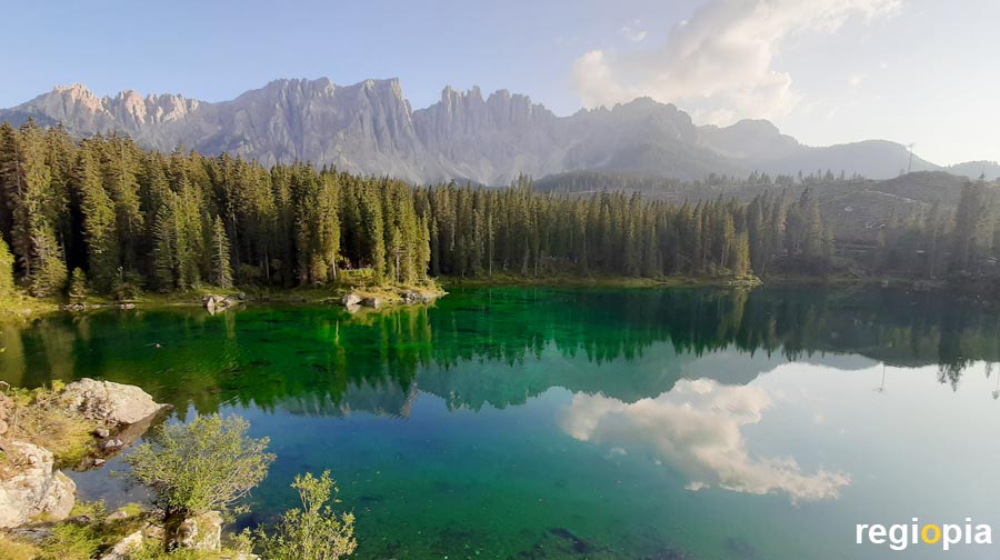
The Lago di Carezza (german: Karersee) is so beautiful that the photos seem fake, but the lake really looks like this. The wonderful mountain lake is located on the SS 241 road between Bolzano and Vigo di Fassa, around 25 kilometers from Bolzano. At the Lago di Carezza there is a large paid car park with a visitor center, restaurants and shops. An underground corridor leads to the lake. There is a terrace from which you can enjoy the view of the green shimmering water with mountains in the background. On the terrace you can watch numerous posing Instagram models.
The Lago di Carezza is at an altitude of 1,519 m, the lake is around 300 m long and 140 m wide. There is a hiking trail around the lake that can be walked around in half an hour. The best light is in the late afternoon when the sun shines on the mountains of the Latemar massif.
Cortina d'Ampezzo
The town of Cortina d'Ampezzo is the most famous ski resort in the Dolomites, and downhill races are held here regularly in winter. Cortina d'Ampezzo is at an altitude of 1200 m and has around 6,000 inhabitants. The famous winter sports resort is located in a valley which is surrounded on all sides by high mountains. As a result, there are many different ski slopes around the town. The 1956 Winter Olympics were held in Cortina d'Ampezzo.
The city center is quite small, the main shopping street is the Corso Italia. Here you will find well-known fashion shops and winter sports clothing. The 70 m high steeple of the Basilica Santi Filippo e Giacomo towers over the city center. In Cortina there are also a few museums worth seeing, such as the Museo d'Arte Moderna Mario Rimoldi or the Museo Paleontologico Rinaldo Zardini.
But the many visitors come to Cortina because of the magnificent mountain scenery. The highest mountain around the town is the 3,244 m high Tofana di Mezzo. The soaring Cique Torri and the Croda da Lago mountain range are the most famous rocks.
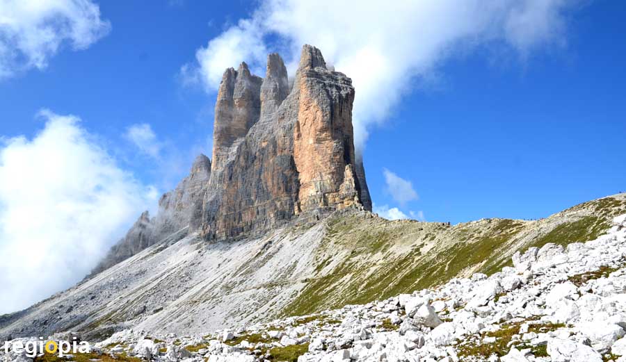
Three Peaks
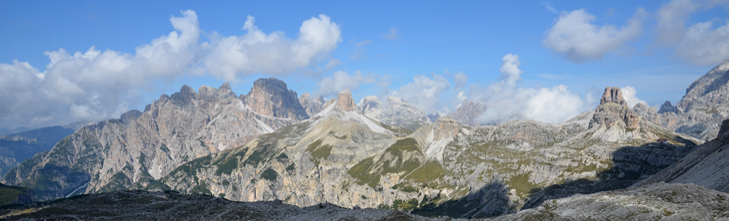
The "Three Peaks" (Drei Zinnen in german or Tre Cime in italian) are the most famous rock formations of the Dolomites. They are the symbol of the region and are part of the UNESCO World Heritage of the Dolomites. The "Three Peaks" consist of the Great Peak (2,999 m), the Western Peak (2,973 m) and the Small Peak, 2,857 m). The circumnavigation of the "Three Peaks" is the most popular hike in the Dolomites. Even inexperienced hikers can circle the rock group in about 4-5 hours. If you are fit and take only a few breaks, you can do it in around 3 hours.
At the Auronzo hut (2,320 m) there is a large parking lot, which can be reached via a toll road that branches off at Lago di Misurina. From the Aronzo hut (see location marker) a path with a slight incline leads along the "Three Peaks" to the Lavaredo hut. From here it goes uphill to the Paternsattel (photo). This mountain ridge is the border between Veneto and South Tyrol. If you have climbed the Paternsattel, you have a spectacular view of the Three Peaks nature park. From the Paternsattel the path leads parallel to the Paternkofel to the Dreizinnenhütte. From here you can see the Fischleintal, which leads to Sexten/Sesto. The Dreizinnenhütte also has the best view of the famous rocks. Those who want to go around the "Three Peaks" descend from the Dreizinnenhütte into a small valley and then climb a very steep and long route to the Langalm Hütte. That is the hardest part of the hike. Once you have reached the Langalm, you have to climb over several smaller bumps until you are back at the parking lot. Numerous spectacular views are well worth the effort.
You can reach the "Three Peaks" without a car, but then you should be very fit because there is a considerable difference in altitude to be overcome. From Sexten/Sesto through the Fischleintal to the Dreizinnenhütte and back can be done in about 8 hours.
www.dreizinnenhuette.com/index.php
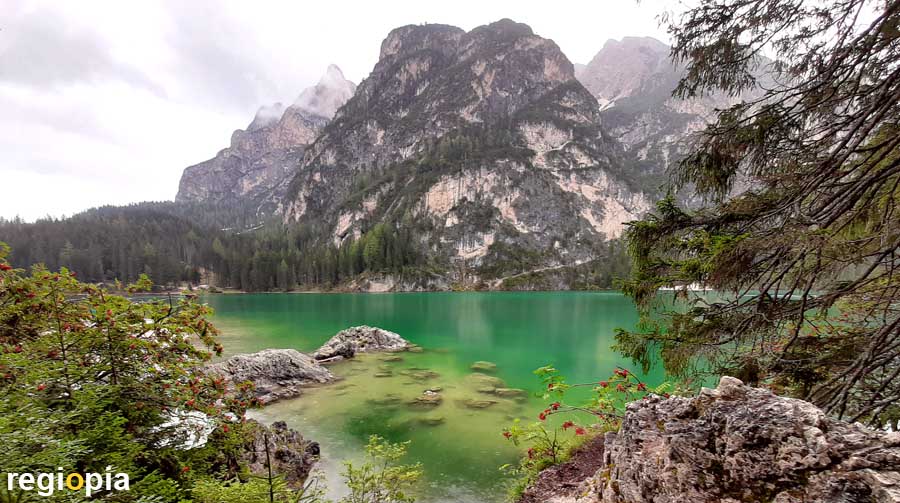
Lago di Braies
The Lago di Braies (german: Pragser Wildsee) is one of the most beautiful lakes in the Dolomites. Since it is easily accessible by a street, a large hotel and parking lots, it is one of the most popular excursion destinations in the region. Around the lake there is a 3-kilometer circular path that runs along the lake shore. The Lago di Braies lies at an altitude of 1,494 m above sea level and is dominated by the 2,810 m high peak of the Seekofel. Excellent food is served in the restaurant of the Hotel Lago di Braies. The hotel was built in 1899 and was the scene of an rescue of Nazi hostages by the Wehrmacht at the end of World War II.
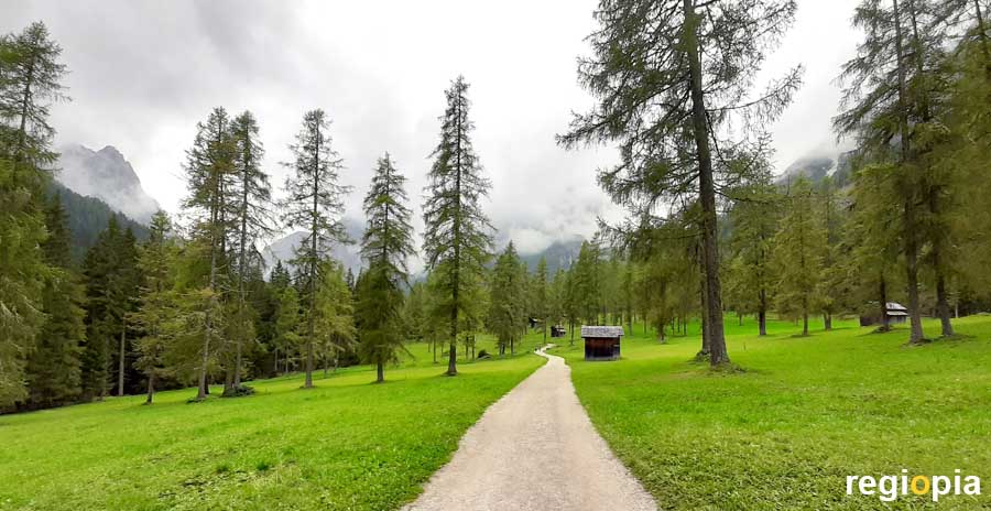
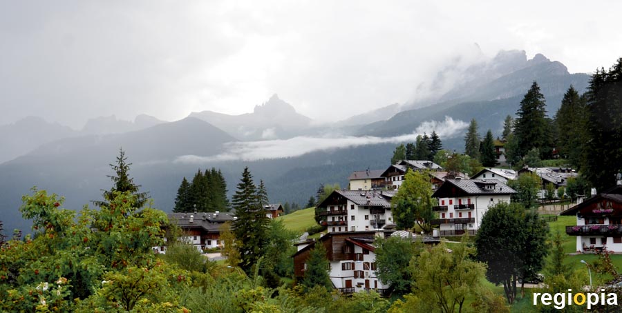
Sexten
From Sexten (italian: Sesto) at an altitude of 1,300 m you can hike through the Fischleinbachtal (italian: Val Fiscalina) to the Talschlusshütte (1,548 m). The approximately 6 km long path leads through meadows and forests until you stand on the broad gravel bank of the creek with a view on the mighty mountains at the end of the valley. Here is the Talschlusshütte (End of the valley hut) with very good cuisine. From here the path leads steeply up to the Dreizinnenhütte. You should only tackle this path if you have the appropriate equipment and fitness.
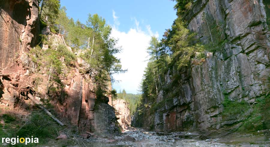
Bletterbach Gorge
The Bletterbach Gorge (german: Bletterbachschlucht) is often referred to as the Grand Canyon of the Dolomites. The comparison is certainly daring, but the Bletterbach Gorge is definitely an impressive backdrop. The gorge is around 8 kilometers long and around 400 m deep. As rock falls are frequent, all visitors should wear a helmet for safety reasons. The helmet can be borrowed from the GEOPARC Bletterbach visitor center for a fee.
The tour from the visitor center to the waterfall and back takes approximately 2 hours. Since the visitor center closes around 6 p.m. in summer, you should start at 3:30 p.m. at the latest. The visitor center is up on the mountain and you first descend into the valley. In the gorge the Bletterbach creek meanders through the scree and you step from one stone to the next creek upwards. When you reach the waterfall, the path ends and you turn around. On the right side, a steep staircase leads back up to the edge of the gorge. This is a tough climb after which a relatively horizontal path leads back to the visitor center.
For current opening times and prices check the link below.
Map of the Dolomites
ads
Travel Guide Dolomites
ads
ads