Zermatt
Zermatt is the most famous winter sports resort in Switzerland, and very probably of the world. Zermatt is famous for the Matterhorn, which towers over the town. Zermatt is located at an altitude of around 1,600 m, in the upper part of the Mattertal. The river Mattervispa flows through Zermatt and through the valley, which joins the Saaservispa to form the river Vispa around 8 kilometers before the city of Visp.
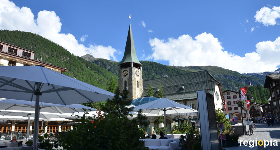
Zermatt was settled early on because it was possible to get to Italy from here over the Theodul Pass. Around the year 1000 it was warmer than today and you could climb over the mountains without ice in summer. At that time Zermatt served as a station on the crossing of the Alps. Today the town lives from tourism, which began around 1852 with the first hotel. Skiers come in winter and hikers and mountaineers in summer. Winter sports are also possible in summer thanks to the glaciers. Today Zermatt has around 6,000 inhabitants. The center is on the church square with the parish church of St. Mauritius (photo).
Bahnhofstrasse
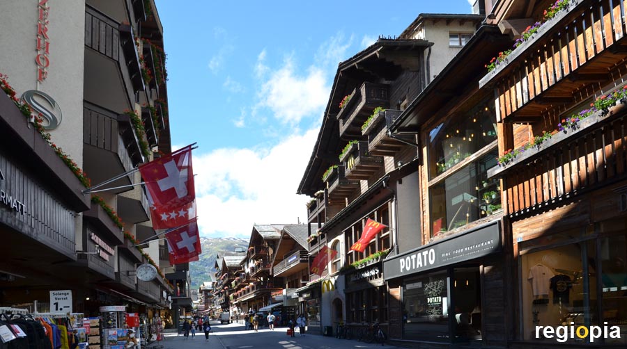
The main shopping street in Zermatt is the Bahnhofstrasse (Station Street). Most of the restaurants, shops and hotels are located along the main street. The Bahnhofstrasse leads from the Bahnhofsplatz to Kirchplatz. There are two train stations at the Bahnhofsplatz (Station Square). From the Swiss railway station you can get to Täsch and Visp. There are connections from Visp through the Rhone Valley to Geneva. The central car park is located in Täsch, from here the shuttle trains go to Zermatt.
The second station belongs to the Gornergrad Bahn. The trip to Gornergrad is one of the tourist attractions of Zermatt. From here you have a magnificent mountain panorama of the Monte Rosa massif, the Gorner glacier and the Matterhorn. However, the mountain railway is very expensive (see link), so you should choose a day with good visibility.
Matterhorn
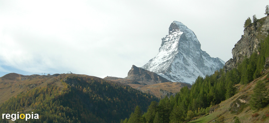
The Matterhorn is the attraction of Zermatt. The 4478 m high mountain is the symbol ofSwitzerland and one of the most famous mountains in the world. The steep rock juts into the sky like a triangular pyramid and since there are no other high mountains around it, the Matterhorn looks very majestic and unique. In summer, the white mountain stands out clearly from the green meadows and forests. Because the Matterhorn rises individually from the surrounding area, a cloud often forms on the leeward side. Warm, moist air is sucked in from the valley and a cloud is created that rises up the mountain and blows away at the top.
The Matterhorn stands on the border between Italy and Switzerland. The mountain forms the border on the Swiss side in the canton of Valais and on the Italian side in the Valle d'Aosta. In Italian, the Matterhorn is called Monte Cervino and the French also call it Mont Cervin.
The first ascent of the Matterhorn was achieved in 1865 by a rope team led by the British Edward Whymper over the Hörnligrad. However, four of the seven climbers crashed on the way back. The Matterhorn attracts several thousand mountaineers every year who try to reach the summit. Some are killed every year.
Hikes from Zermatt
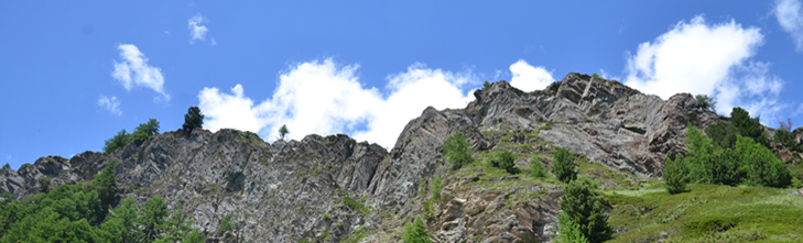
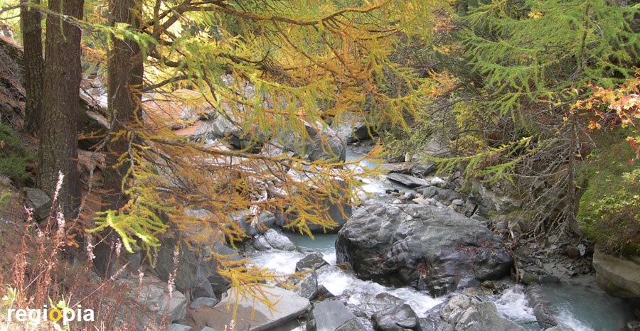
In the summer months you can go on hikes from Zermatt, during which you always have the magnificent mountain panorama in front of your eyes. One of the most famous routes leads along the creek Zmuttbach (photo) towards the Matterhorn. The hike leads through forests and meadows to the Zmutt mountain village.
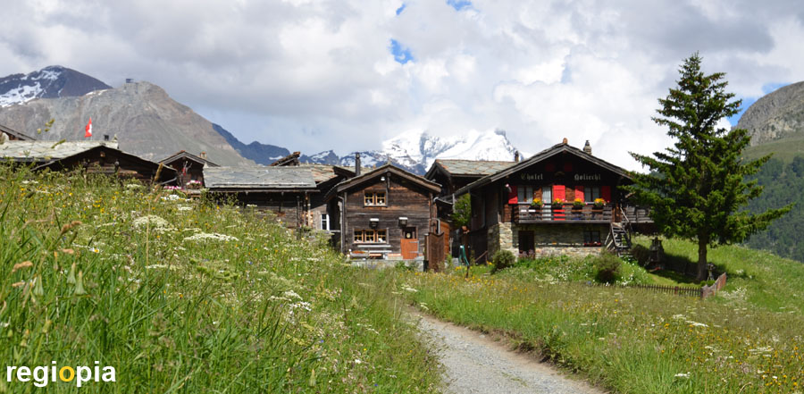
Zmutt
The small mountain village of Zmutt is located at an altitude of 1936 m, about 3 kilometers from Zermatt. If you are fit, you can do the route in an hour. In Zmutt there are several restaurants with typical dishes of the region. The picturesque village consists of old wooden houses and is surrounded by mountain meadows. In the background you can see the snow-capped peaks of the Alps.
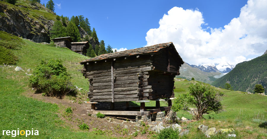
Mountain meadows and wooden stacks
If you choose the Kulturpfad (culture trail) from Zermatt to Zmutt, you will see more nature. The path is narrower and steeper than the Edelweißweg along the Zmuttbach creek. And there are not as many tourists on this trail. On the way you can see the typical wooden hay stacks (photo) with the round stone slabs at the support points. These are supposed to prevent rats from nesting in the hay. This path also leads to Zmutt, but is a bit more strenuous because it leads further up. If you want you can walk further on to the reservoir, but the small lake is not a worthwhile destination.
From Zermatt there are numerous hiking options with different levels of difficulty. Thanks to the well-developed mountain region, you can also start higher up using the cable cars. For more information see Zermatt Tourist Information (Link).
Map of Zermatt
ads
Travel Guide Zermatt
ads
ads