Chichén Itzá
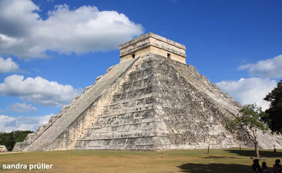
The pyramid of Chichén Itzá is one of the most beautiful Mayan buildings on the Yucatan Peninsula and thus the most famous sight in the region. Chichén Itzá was built between two cenote (water holes) and thus had access to groundwater. The name Chichén Itzá means "water well of the Itzá". It is believed that the city was founded around 400 by the Mayans and around 1,000 conqured by the Itzá (a tribe of the Toltecs originating in Central Mexico). In the archaeological site there are traces and structures from both cultures. Around 1461 the place was most likely abandoned and the residents moved south.
The archaeological area is around 1.5 kilometers long and consists of many buildings. The best known is the temple pyramid which is also called El Castillo (photo). The Gran Juego de Pelota football field is also very famous. The sports field is bordered by two high walls, from which a stone ring protrudes above. The ball had to be played through this hole to score. The Mercado is an area with many columns, which borders on several temples, of which only the remains of columns protrude from the jungle. Osario is a small pyramid with four stairs up near the Cenote Xtoloc. The Cenote Sagrado is located in the very north of the ruined city.
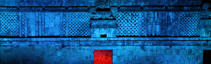
Chichén Itzá has been a UNESCO World Heritage Site since 1988. The excavation site is very large, Chichén Itzá was the most important city of that time. The ruins are illuminated at night, if you want to experience this spectacle, you should ask at the entrance for the time.
Chichén Itzá is located near Pisté, around 110 km east of Mérida or 36 km west of Valladolid.
www.inah.gob.mx/zonas/146-zona-arqueologica-de-chichen-itza
Izamal
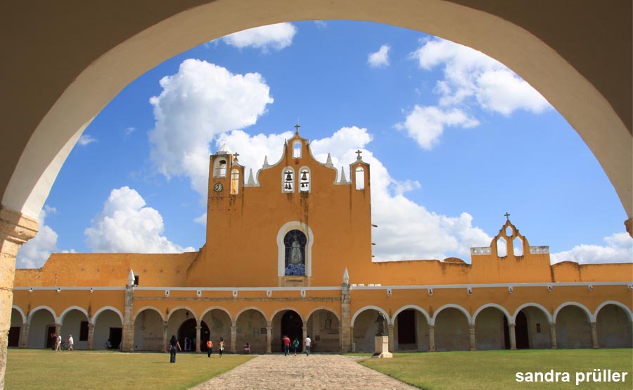
Izamal is a small town around 60 kilometers east of Merida. Izamal is known for the Convento de San Antonio. The Franciscan Monastery was built in 1549 on a former Mayan platform. Izamal was an important Mayan city in the pre-classical period around 500 BC. There are several Mayan pyramids in the city. The Pyramid de Itzamatul is located in a city block area. The entrance is south of the intersection of Calle 26 and Calle 29. The slightly larger Kinich Kakmó pyramid is located between Calle 27 and Calle 23. The entrance is on Calle 27. From the top of the pyramid you can see far over the flat land of Yucatan. The structure itself is not very impressive, but it is much older than the famous pyramids of Yucatan.
The town of Izamal captivates with its colonial architecture with yellow arcades around the central square. The name Izamal means "place of the iguanas". The lizard-like Itzamná was the highest god of the Maya and responsible for rain and fertility.
Tulum
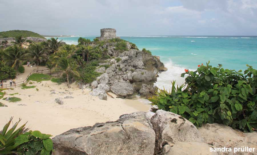
Tulum combines the two trademarks of Yucatan, Mayan temples and the Caribbean Sea. The ruined city lies on a rock directly on Playa Tortuga. Tulum is a wonderful place because there is a wide protection zone around the ancient town. The archaeological site is surrounded by forest and there are no hotels nearby on the beach.
Tulum was a Mayan city that developed around 1200 and became one of the most important trading cities on the Yucatan Peninsula. When the Spaniards discovered the place in 1518, Tulum was still a pulsating center. With the decline of the Mayan civilization, Tulum was abandoned.
The archaeological site is well maintained and looks like a park with Maya buildings. A clear route ensures that visitors do not walk over the remains. Noteworthy buildings include El Castillo (castle). The tallest structure in Tulum consists of a steep staircase that leads to a platform with a tower on top. The structure that you can see from the beach is the Templo del Dios del Viento (Temple of the Wind God). A bit off the coast are the two Mayan ruins of Templo del Dios Descendente (Temple of the Descending God) with a frieze on which the bee god is depicted and the Templo de las Pinturas (Temple of Images) with beautiful wall paintings.
Tulum is located in the state of Quintana Roo, around 60 kilometers south of Playa del Carmen.
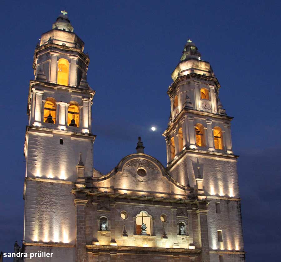
Campeche
Campeche is the capital of the mexican state of Campeche. The city has over 200,000 inhabitants, making it one of the largest cities on the Yucatan Peninsula. UNESCO has declared the city of San Francisco de Campeche a World Heritage Site because of its baroque fortifications and its historic old town. The city is a well-preserved example of a fortified port city from the Spanish colonial era. The Spaniards founded the city in 1540 and named it after the Mayan settlement Kaan Peech, which was located here. The city quickly became the main port in Yucatan and was therefore attacked by pirates. The city fortifications were built in 1688 and still surround the historic centre. The bastions have been preserved but parts of the wall have been removed. The old town of Campeche consists of small, colorful houses with very high walkways. Campeche Cathedral is the most beautiful building in the proud city.
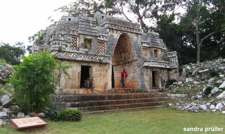
Labná
The ruined city of Labná had around 2,000 inhabitants between the 7th and 9th centuries. The structures were built in the Puuc style. In Labná you can find the early Puuc style, the pillar style and the mosaic style. The buildings can be dated based on the architectural styles.
Labná is known for its archway Arco Triunfal, which was built as a cantilever vault. The cantilever vault is not a real arch, but is constructed by cantilevered panels that are held by gravity. The Arco Triunfal has an east and a west side, each with different decorations. The Labná archway became world famous when the British-American research team Stephens and Catherwood discovered the lost city in 1842 and a drawing of El Arco went around the world.
The Gran Palacio is another attraction of Labná. Several richly decorated parts of the building form the palace of the Maya city. The temple pyramid El Mirador with a high cornice that is decorated with figures is another major sight. The rest of the pyramid, however, only consists of a loose pile of stones. The former residential building of the upper class Edificio de las Columnitas is located on the eastern edge of the archaeological site. The facade is decorated with numerous small columns.
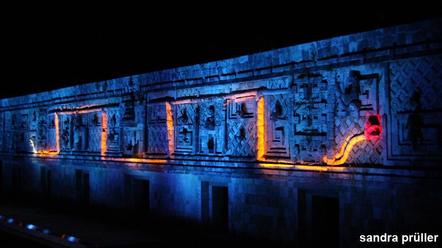
Uxmal
Uxmal was an important city with up to 25,000 inhabitants during the Maya period. The city was built around 800 and abandoned around 1200. Uxmal was by then the capital of the Maya dynasty Tutul Xiu, who moved their capital later to Mani. Uxmal is 50 m above sea level and was surrounded by valleys in which water collected. The groundwater was 65 m below the surface and not accessible to the Maya. This was unfavorable for longer dry periods. Mani lies deeper and has therefore access to groundwater.
Uxmal is famous for its Mayan pyramids, there are 3 tall temple pyramids in the city. The largest is the approximately 35 m high Adivino pyramid also called Pyramide del Mago (pyramid of the magician). There are several courtyard-shaped palaces, the 100 m long Palacio del Gobernador (Governor's Palace), the Juego de Pelota ball playground and many temples.
One of the main sights of Uxmal is the Cuadrángulo de las Monjas. The rectangular square is surrounded by astonishing facades with artistic wall details.
The Uxmal archaeological site is around 70 kilometers south of Merida and has been a UNESCO World Heritage site since 1996.
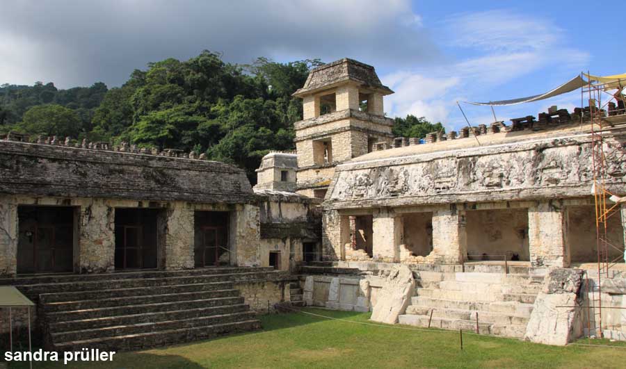
Palenque
Palenque is located in the very south of Yucatan, in the Mexican state of Chiapas. The Mayan civilization's settlement area stretched from the Caribbean coast of Yucatan to the Pacific in Chiapas and beyond the country's borders to Guatemala and Belize.
Palenque was a Mayan city that originated around 400. In 611 the city was raided and destroyed by Calakmul. Palenque was rebuilt until 700, so most of the buildings date from the years between 650 and 750. Palenque was abandoned around the year 800, the reasons for this is still unknown.
The largest building in Palenque is the palace El Palacio (photo) with several courtyards and a tower. South of the palace are three temple pyramids with the architecture typical of Palenque. The temples of the step pyramids have alle a filigree roof attachment. This comb makes them look taller and more elegant. The so-called cross group consists of the cross temple, the leaf cross temple and the sun temple. Each temple was built for a different local deity.
A royal tomb was also found in Palenque, with a death mask made of jade. Because the burial chamber was under water, it was not looted. The grave was under the Temple of Inscriptions and is assigned to Pakal I who died in 683.
The archaeological zone is around 7 kilometers south-west of today's city of Palenque.
Map of Yucatan sights and attractions
ads
Yucatan - Mexico
ads
ads